A new debate has emerged in global politics after discussions suggested that Britain could play a role in helping to resolve long standing border disputes in the Himalayan region by using colonial era maps. The idea has created strong reactions among historians diplomats and political experts because the Himalayas remain one of the most sensitive and complex border zones in the world.
The Himalayan region includes disputed and overlapping claims between major countries such as India China and Nepal. These disputes have existed for many decades and in some cases for more than a century. The suggestion to use old British colonial maps has reopened discussions about history geography and modern international law.
Many experts believe that historical documents can sometimes help clarify border confusion. Others argue that colonial era maps are outdated and may not reflect present day realities on the ground. This difference of opinion has made the topic widely discussed in international media.
Why Colonial Era Maps Are Being Discussed
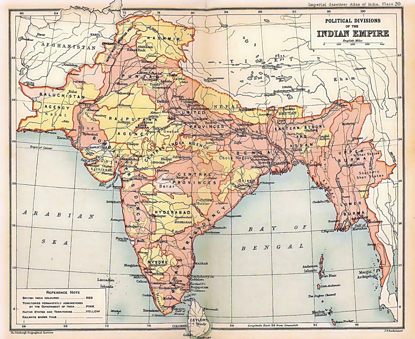
During the British colonial period many parts of South Asia were mapped by surveyors working under the British administration. These maps were created using the technology and knowledge available at that time. Some of these maps included detailed geographical information about mountains rivers and valleys in the Himalayan region.
Supporters of using these maps believe that they may provide useful reference points for understanding historical boundaries. They argue that some modern disputes exist because different countries interpret historical records in different ways.
They also believe that having a shared historical reference could help reduce misunderstandings between nations. In highly sensitive border regions even small differences in interpretation can lead to serious diplomatic tension.
However critics strongly disagree with this idea. They say that colonial maps were never designed to serve as permanent international boundaries. Instead they were created for administrative control and military purposes during the colonial period.
They also argue that geographical conditions in the Himalayas have changed over time due to natural shifts landslides and environmental changes. This makes it difficult to rely fully on old maps for modern border decisions.
Background of Himalayan Border Disputes
The Himalayan border region is one of the most complex geopolitical areas in the world. It stretches across high mountains deep valleys and remote terrain that is difficult to access.
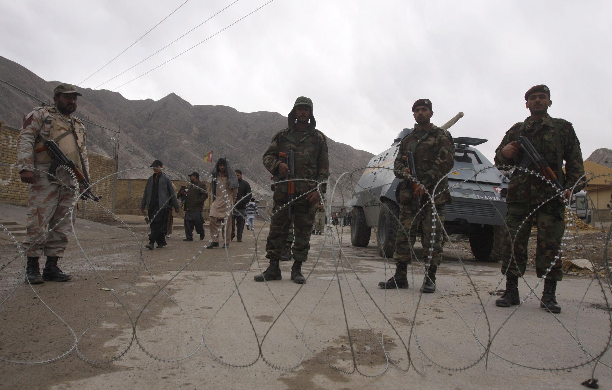
India China and Nepal all share long mountain borders in this region. Over the years there have been disagreements about where exactly these borders lie.
One of the most well known disputes is between India and China along the Line of Actual Control. This area has seen tensions and occasional clashes due to different interpretations of the boundary line.
Nepal also has ongoing discussions with neighboring countries regarding certain border areas. These issues often involve historical agreements maps and changing geographical references.
Because of the difficult terrain and lack of clear natural markers in some areas defining exact boundaries has always been challenging.
Why Britain Is Being Mentioned
Britain is being mentioned in this discussion because of its historical role in mapping and administrating parts of South Asia during the colonial period. British survey teams created some of the earliest detailed maps of the Himalayan region.
Some analysts believe that British archives may still contain valuable historical documents that could help clarify old boundary claims.
The idea is not that Britain should decide borders but rather that it could provide access to historical mapping records that might support diplomatic discussions.
Supporters of this idea say that neutral historical data could help reduce disagreement between countries by offering a shared reference point.
However many experts also warn that relying on colonial history in modern geopolitical disputes can be sensitive. It may reopen historical grievances and create political tension rather than solving problems.
Expert Opinions on the Proposal
Geopolitical experts are divided on whether colonial era maps should be used in modern border disputes.
Some historians believe these maps can be useful starting points for discussion. They say that historical documents often play a role in international arbitration cases and boundary settlements.
They also point out that many modern borders around the world were influenced by colonial mapping systems even if they have been modified over time.
On the other hand international law experts argue that modern borders must be based on current agreements and recognized legal frameworks. They say that relying too heavily on old maps could create confusion because mapping accuracy in the past was limited.
Satellite technology today provides much more precise geographic data. Many governments now rely on modern surveying tools rather than historical maps when discussing boundaries.
Importance of the Himalayan Region
The Himalayan region is not only important for political reasons but also for environmental and economic reasons.
It is home to some of the highest mountains in the world and contains major river systems that support millions of people in South Asia.
Any border dispute in this region is highly sensitive because even small tensions can affect trade security and regional stability.
The area also has strategic importance because it connects several major Asian countries. This makes border stability a key priority for governments involved.
Tourism also plays a role in the Himalayan region economy. Many visitors travel to see mountain landscapes and cultural heritage sites.
Challenges of Using Old Maps Today
One of the main challenges of using colonial era maps is accuracy. Mapping techniques in the past were limited compared to modern satellite imaging systems.
Some areas may have been measured incorrectly or based on estimates rather than precise coordinates.
Another challenge is interpretation. Different countries may interpret the same map in different ways which can create further disagreement instead of solving it.
Environmental changes also play a role. Rivers can shift over time glaciers can melt and landscapes can change which makes old geographic references less reliable.
Because of these challenges many experts believe that historical maps should only be used as supporting evidence rather than final authority.
Role of Modern Technology in Border Resolution
Today countries use advanced satellite imaging and GPS technology to study borders with much greater accuracy.
These tools allow governments to see detailed topographical changes and create precise digital maps.
International organizations also use modern mapping systems when helping mediate border disputes.
Experts believe that combining historical records with modern technology may provide the best approach. Historical maps can offer context while modern data can provide accuracy.
Diplomatic Sensitivity in Border Issues
Border disputes are not only technical issues but also political and emotional ones. National identity and historical memory often play a major role in how countries view boundaries.
This is why discussions about borders can become sensitive very quickly.
Diplomatic negotiations require careful communication and mutual respect between all parties involved.
Even suggestions about using historical colonial maps can be interpreted differently depending on political perspective.
Public Reaction and Global Interest
The idea of using colonial era maps has gained attention in international media and online discussions.
Some people see it as a creative way to bring historical clarity to complex disputes. Others see it as reopening old colonial history that should not define modern borders.
Public opinion is mixed but many agree that peaceful dialogue is the most important goal.
Global observers continue to watch how India China Nepal and other stakeholders respond to such suggestions.
What Could Happen Next
At this stage the idea remains a discussion rather than an official policy. No final decision has been made regarding the use of colonial era maps in formal border negotiations.
If countries involved in Himalayan disputes decide to explore historical mapping records it would likely be part of a broader diplomatic process.
Any final resolution would require agreement between the nations involved and may take years of negotiations.
For now the situation highlights how history geography and modern politics continue to intersect in complex ways.
Conclusion
The discussion about Britain potentially using colonial era maps to assist in Himalayan border disputes shows how deeply historical records still influence modern international relations.
While some believe these maps may provide useful context others argue that modern technology and current agreements should remain the main foundation for border decisions.
What remains clear is that the Himalayan region continues to be one of the most geopolitically important and sensitive areas in the world.
As discussions continue the hope among many experts is that peaceful dialogue and cooperation will guide any future progress in resolving long standing border issues.